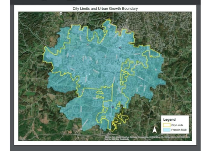
Over the Summer and this Fall, Franklin city government staff has been working with the community and important stakeholders on new Urban Growth Boundaries. It is time to make plans for where Franklin will grow over the next 20 years, as the question is not if the city will grow, but where. More than 2,000 people are moving to Franklin per year, and there is no foreseeable slowing any time soon.
Franklin’s Urban Growth Boundary plan is part of a larger plan being created by the county and all of the other municipalities. Once each individual community has created a working document, then they will all be put together to see where there are conflicts that will need to be worked through.
Community interaction concerning UGBs in Franklin began with a kick-off meeting on August 12 to get feedback from residents living in areas wishing to be incorporated into the city, those that wish to be removed, and a discussion of natural growth patterns. After the initial meeting, there were smaller meetings in areas that will be most affected by possible changes. These areas include the Southwest Basins, Mayes Creek Basin, Goose Creek Basin, and all other basins. The Goose Creek and Mayes Creek meetings had the greatest attendance. The most written comments concerned the commercial node at North Chapel Road and Highway 96, and Fieldstone Farms.
There are five goals provided by the state concerning the plan: To incorporate as compact an area as possible while still making accommodations for growth; to ensure that growth areas are contiguous to existing boundaries; to use economic trends, historic experience, population growth patterns, topographical characteristics, and available infrastructure to identify territory that a “reasonable and prudent” person would deem as likely growth areas; to locate areas where the City of Franklin is better able to provide utilities and other necessary services; and to control expansion what will impact forests, agricultural land, recreation areas, and wildlife refuges.
At a recent Board of Mayor and Alderman work session, it was discussed that the new UGBs may affect zoning ordinances, however, areas that have already been discussed as staying rural – like Gentry Farm – will not be affected. These zoning changes will most likely occur in areas in the new city boundaries that do not conform to current overlays, like scenic corridors, hilltop districts, and historic areas. The new zoning rules will also take into consideration property that is now in the 100-year and 500-year flood plain.
Later this Fall or early Winter the staff will provide a final draft of the UGB map for consideration of the Board of Mayor and Aldermen before it is presented at the county-wide meeting. After all conflicting overlaps are worked through, then a final draft will be approved by the Board as a working document for the next 20 years.
Please join our FREE Newsletter


