
The NWS warns of continuing extreme heat indexes as temps reach the mid to upper 90’s and humidity remains at high levels. Heat Monday afternoon could reach as high as 105*. As far as the heat goes, there seems no long term immediate relief as temperatures are forecasted to remain in the mid to upper 90’s thru at least Friday.
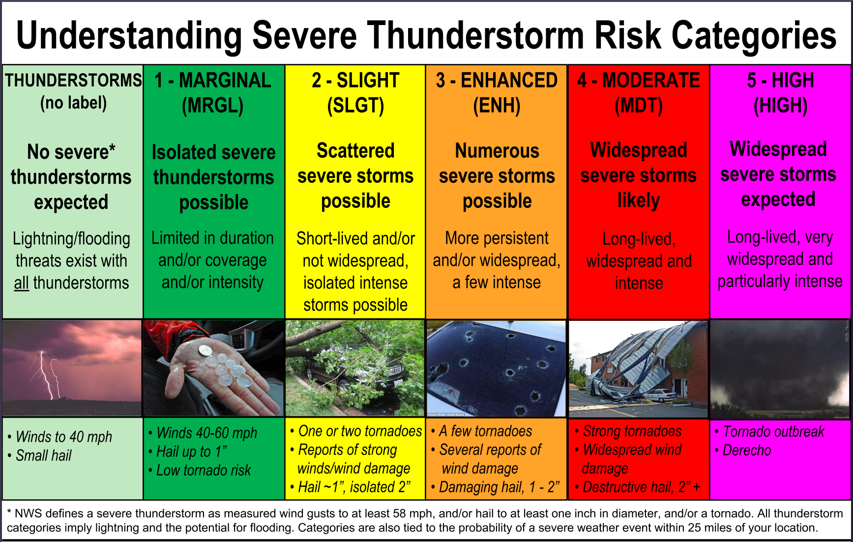
Temporary relief from the heat will be a blessing and a curse as waves of severe weather drop down from the North. Severe storms battered Indiana Sunday evening and dropped widespread flash flooding through Louisville. A line drawn from Franklin to the east of Tennessee , has part of Williamson County in an “Enhanced ” chance for severe weather late this evening thru early afternoon tomorrow:
Williamson Source will be monitoring the weather. You can watch our radar and updates HERE . Follow us @williamsonsrc on Twitter or @WmsonSevereWx and on Facebook
Please join our FREE Newsletter


